It’s unclear whether I was just passing notes during these lessons in middle school, or perhaps my internal GPS chip was somehow dislodged during a hair teasing incident circa 1985. Whatever the reason, I am stuck with a bit of directional dyslexia. Normally, this wouldn’t be a life altering problem, but I was born to be a traveler, and a travel planner. Part of my job as the master of the traveling schedule is to plan an efficient itinerary that groups destinations into a logical geographical order. Most of the time, I rely on a combination of crossed fingers and dumb luck to do this task, but that backfires often enough that I began searching for a more reliable planning tool.
On a recent road trip to Houston, we were really packing in the stops and I felt we were spending way more time than necessary criss-crossing the city. I mused aloud that what I really wanted was a program that I could plug addresses into and it would spit out a map showing me which locations would be grouped together. A quick Google (and let us pause here for a moment to pay homage to the great Google) led me to Multiplottr.
I am in love. Usually technology leaves me cold, but this program does everything I want and then some. Plus, it user friendly and intuitive-an important feature for me as my tech skills rank just slightly above my map reading skills.
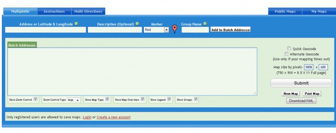
Let me show you how it works. Start with a list of addresses that you want to visit and plug them into the address batch filter. At the same time you can add a description for each address, which will help you to identify them once they are in your map. You might also want to group your addresses into categories like restaurants, must-sees, museums, etc. Later on you can filter your map by category if you choose. You can even change the color of the marker for each category if you’d like an extra fancy map.
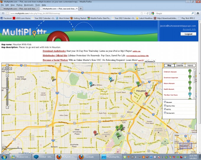
Once you have plugged in all your addresses, you create your map and start planning. Thanks to this little color coded wonder, you can easily see which attractions and restaurants are geographically close and plan your days accordingly.
The program is free to use (although a donation is accepted and deserved, in my opinion), but you do have to sign up for an account to save your maps. Maps can be exported to Google maps and can even be converted into HTML so that you can upload them to a website. Best of all, your planning will be much easier, and you kiss your map reading woes goodbye.
Looking for more great tech traveling apps? Check out these travel blogger favorites!
Trip Doc from Debbie Dubrow at Delicious Baby is a great I-Phone app that has similar capabilities as Multiplottr.
Traci Suppa at Go Big or Go Home shares her reviews of the best travel apps at App Smitten
For great photo apps, check out Keryn's suggestions for photos on the go at Walkingon Travels.


I may have a bit of directional dyslexia myself so this looks like an awesome tool – can't wait to try it out!